This is a 6-week course, covering 6 topics. The topics will be released every Tuesday 00:00 UTC.
There are no prerequisites for this course.
It is expected for the students to spend 4-6 hours on the topic materials and participate in the discussion forums.
For those pursuing a Verified Certificate, you must achieve a Passing Mark of 50% overall in this course. The Passing mark is comprised of a series of questions throughout the course (50%) and an End-of-Topic test (50%). Students are expected to have completed all assignments and questions before the end of the course in order to obtain the Verified Certificate.
By the end of the course you will be able to...
- Identify different spatial data types and their potential sources;
- Apply simple GIS analysis, such as overlays and buffers, to begin understanding spatial data;
- Identify and differentiate the difference between satellite and aerial photography;
- Recognize methods for processing photographic results to generate useful meaning to data;
- Identify different types of Condition Survey;
- Differentiate between the technologies used for Underground Asset Management and Non-Destructive Testing;
- Differentiate between indoor and outdoor positioning methods;
- Summarize the different components to various positioning methods;
- Explain how Geospatial Technologies and Spatial Data fit into a Smart City.
The course structure for the 6 weeks are as follows:
 Week 1: Urban Environment
Instructors: Dr. Man-Sing Charles WONG, Prof. Lilian S.C. PUN-CHEUNG, Ir. Dr. Wallace W.L. LAI
Invited Guests: Prof. Mei-Po Kwan
The Urban Environment could be loosely interpreted as the neighborhood and city. It is a complex system and it has its own share of issues.
This section introduces the urban environment and issues it faces such as traffic, health, and environmental pressures. It briefly introduces how Geospatial data can help alleviate the problems from the city, what it can contribute to the decision-making process.
 Week 2: Geographic Information System (GIS)
Instructors: Prof. Lilian S.C. PUN-CHEUNG, Dr. Xintao LIU, Dr. Xiaolin ZHU
Invited Guests: Prof. Michael GOODCHILD, Prof. Mei-Po KWAN, Dr. Yun ZHANG
A GIS is more than a simple software installed on a computer, it has the ability to visualize, analyze, and interpret patters, relationships, and trends of spatial data. It is a valuable toold for organizations, governments, and even private businesses.
This section looks at the role of GIS in solving Urban Environmental issues, how data are analyzed inside a GIS, its application and how it is integrated into society.
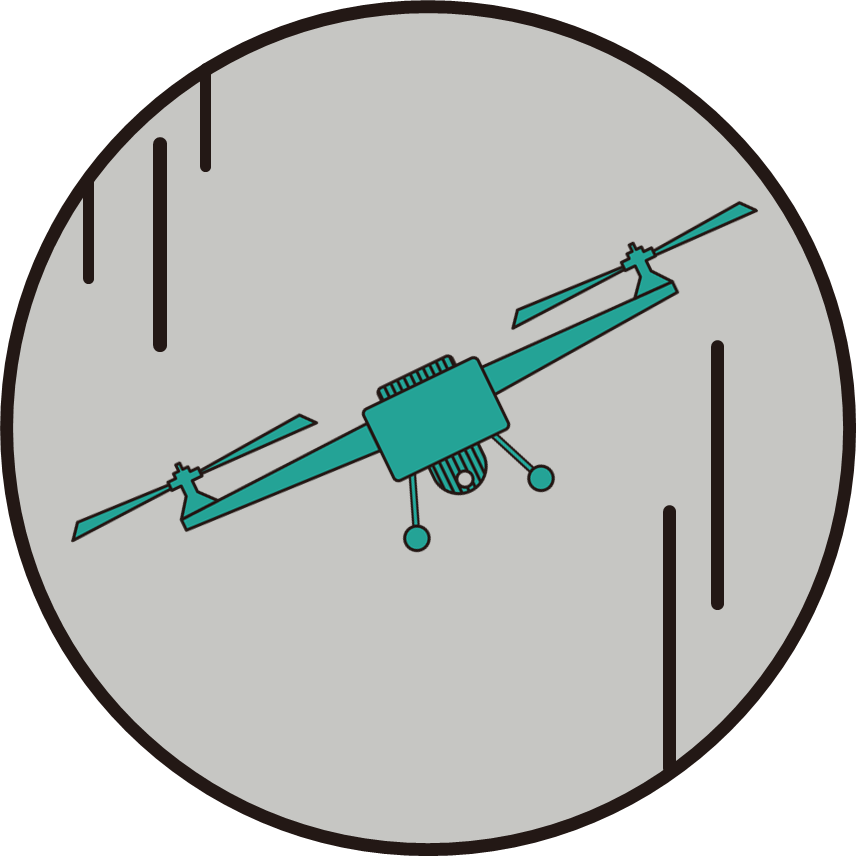 Week 3: Remote Sensing
Instructors: Dr. Man-Sing Charles WONG
Invited Guests: Prof. Peter ATKINSON, Dr. James GARRISON, Prof. C.K. SHUM
Guest Presenters: Mr. Sawaid ABBAS, Dr. Muhammad BILAL, Dr. Majid NAZEER
It is common to associate Remote Sensing with Photography as results of satellite observations and aircraft measurements are often presented as photos But Remote Sensing is more than photos. It is a technique to acquire information about an object without contact.
This section will introduce the history and techniques behind current Remote Sensing, how data are acquired through the technology and how they are processed.
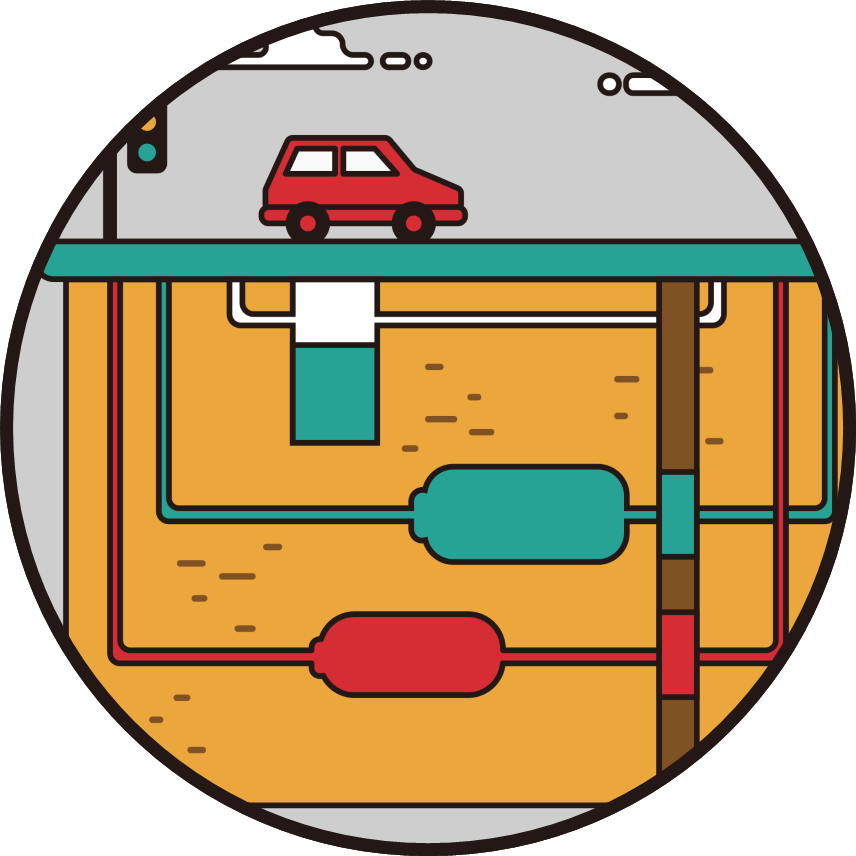 Week 4: Underground Survey and Mapping
Instructors: Ir. Dr. Wallace W.L. LAI
Invited Guests: Prof. Tom ISELEY
The Underground is a complex spiderweb of pipes and cables, embedded within a bed of material such as soil, clay or even rock. Seeing above ground is easy, accessing the underground is hard, often requiring road works and inconveniences to the public. As underground assets are arteries and veins to any settlement; an invaluable resource in a city and must be properly managed and maintained.
This section introduces the types of technology and the methods to 'See the Unseen', the reasons for underground asset management, and types of condition survey.
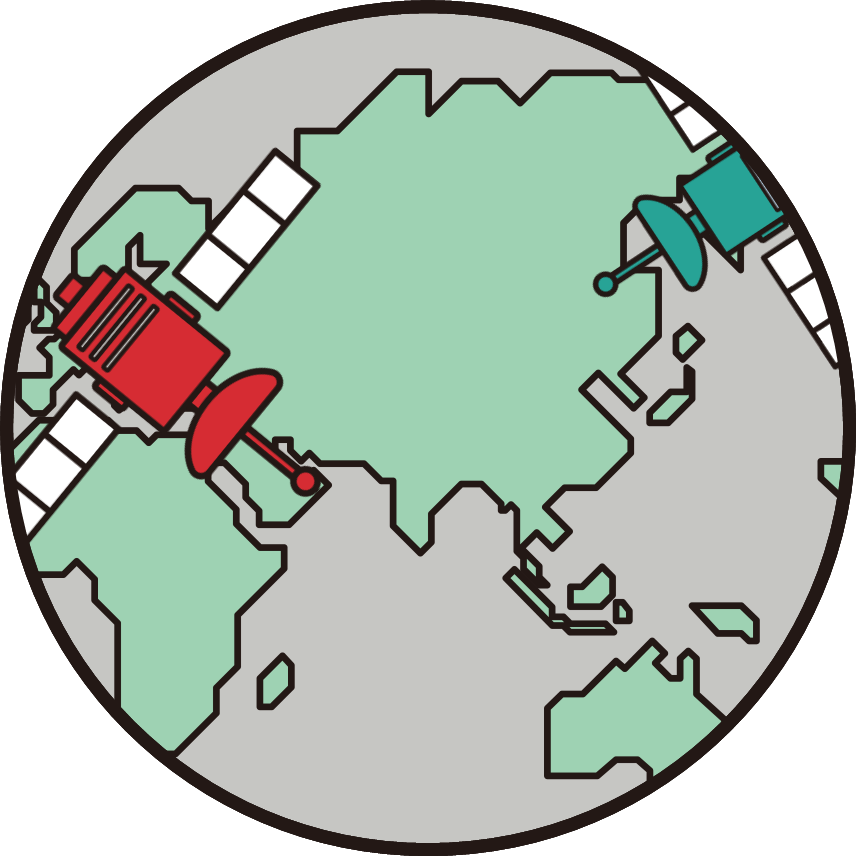 Week 5: Navigational Systems
Resource Contribution: Prof. Wu CHEN, Sr. Prof. Esmond MOK
Positioning and navigation has become integral to everyday living, especially after the advent of online mapping tools such as Google Map and Open Street Map. Route plotting is no longer an exclusive knowledge privy to GIS analysts and experts as simple software allows anyone to navigate given an Origin and Destination. It has also extended beyond the outdoors with indoor navigation made possible using WiFi and Bluetooth.
This section looks at how to position a device and how to navigate within the urban environment. It explores outdoor positioning, looking at methods and techniques used by GNSS, and indoor positioning and its use.
 Week 6: Smart City
Instructor: Prof. Wenzhong SHI
Invited Guests: Prof. Michael GOODCHILD, Dr. Michael BATTY
The concept of Smart City revolves around data, access, resilience, connectivity, and sustainability. A Smart City helps connect people, enables efficiency, is self-sustaining and resilient to adverse effects and change. it is an evolution from the everyday city, using data as a catalyst and enabler to improve on itself.
This topic introduces what is a Smart City, where Big Data comes from, and how to use this Big Data to shape our world.